Innovative Dashboards: Improving Data Quality and Communication for Field Programs
In geotechnical design, field data collection practices strongly influence project success. Equilibrium has developed an innovative approach to improve geotechnical data collection and QAQC processes. Live, client-accessible dashboards provide a holistic view of the data collection process, going beyond traditional core logging processes by making data available to all project stakeholders soon after it’s collected. The dashboards allow for better communication, streamlined collaboration, and continuous improvement.
How does data collection impact geotechnical design?
Traditional QAQC methods do not always capture logging errors and inconsistencies early in the process. Even where these errors or inconsistencies are identified, they are not typically identified in a timeframe that allows near real-time feedback to the field personnel. This can have a cascading impact on downstream design.
Core logging does not happen in a pristine, controlled laboratory environment. Often, the task falls to junior and intermediate staff working quickly to keep pace with rapid drilling rates while dealing with cramped, noisy, and remote conditions on 12-hour shifts. In such an environment, inaccuracies can slip in unnoticed and replicate if not caught immediately.
Unreliable data can lead to rock mass characterization that does not accurately represent in-situ conditions. At best, this results in re-work and lost time. At worst, it can lead to increased safety risks or lost optimization opportunities.
To exacerbate the problem, QAQC is often completed only after the hole has been entirely drilled and logged. Any systematic or consistent errors, when identified, must then be corrected afterward, often requiring manual data reconciliation and potentially costly redrilling. This delayed feedback also means core loggers are not pro-actively improving their core logging skills and looking for potential QAQC issues.
A snapshot of Equilibrium’s data collection workflow
Ongoing collaboration among stakeholders—from clients to drillers and other service providers—is critical to the overall success of a project. A live dashboard makes this possible. When all stakeholders can visualize the data, they can closely follow the progress of the field investigation and provide relevant feedback for program improvement. This creates opportunities for immediate adjustments to the field program, facilitates coordination, and allows for faster decision-making.
How it works:
Core loggers collect data in the field and upload it to an internal cloud server at the end of each shift. As part of the data upload process, the data is run through automated QAQC processes to flag and address any errors or inconsistencies. Intermediate or senior engineers then check for errors in the core logging data and photos to make sure that the data collected are representative of the observed condition of the core. This review happens concurrently with the field program.
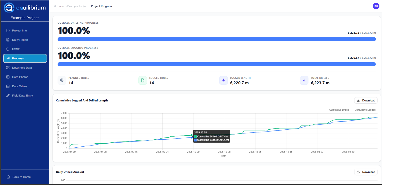
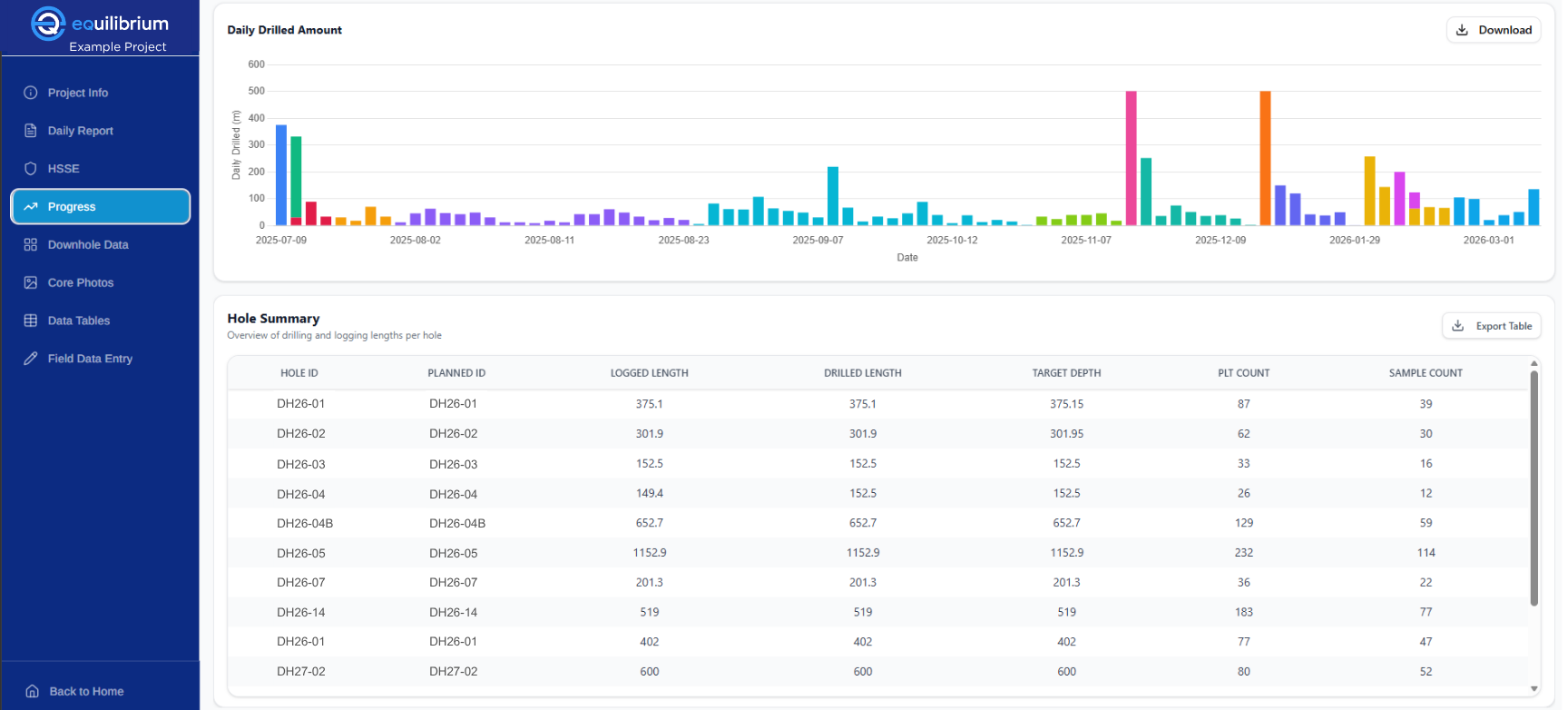
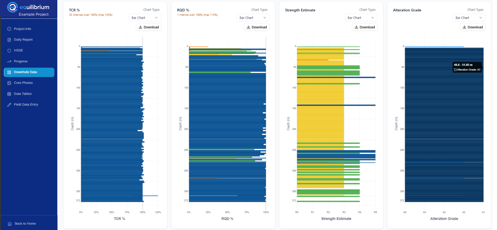
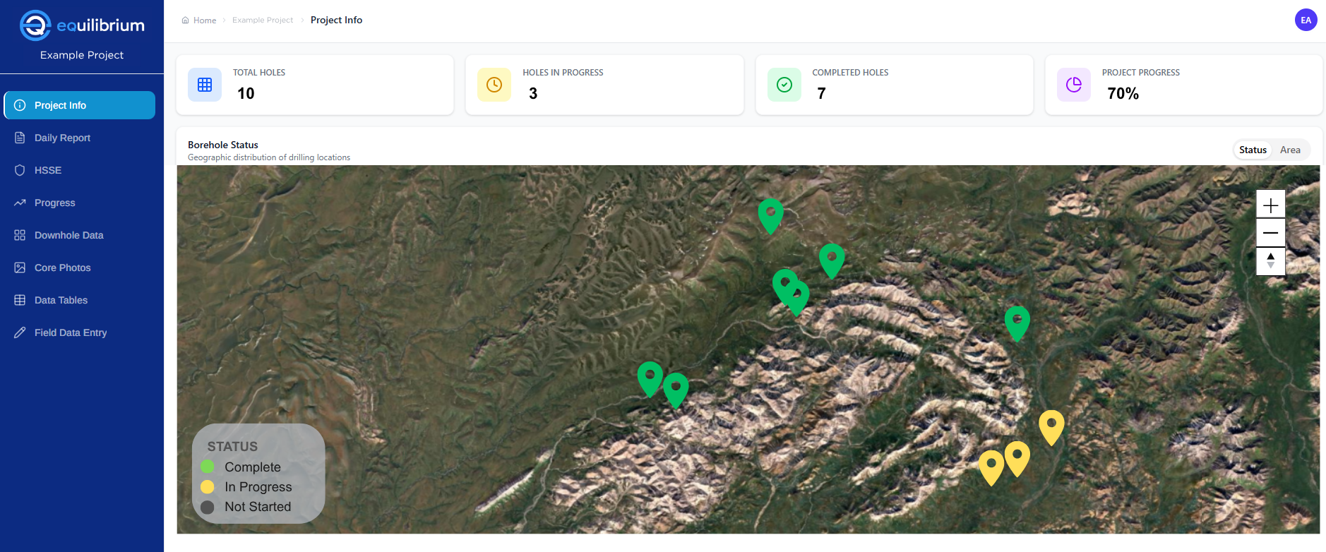
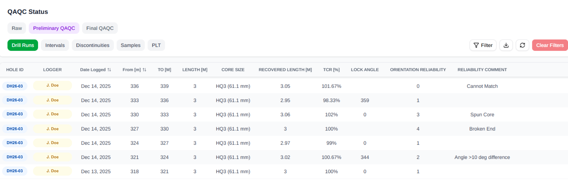
Once approved, they are passed into the data management system where they become fully accessible to stakeholders through a straightforward, interactive dashboard. These dashboards can display project progress, core photos, statistics and data tables, downhole plots, geophysics and hydrogeology testing status, key performance indicators, health and safety information, and more. Downhole plots can be interactively reviewed to compare the processed field data to the core images in splits and boxes. The corrected data is then flagged within the system as having undergone preliminary QAQC.
Overall drilling progressDaily drilled amountDownhole data
Findings from this review process are communicated back to the field team within a day, while they’re still on the drill rig or in the core shack, so they can immediately implement any necessary changes. This continuous feedback loop allows the field team to improve their data collection skills and ultimately reduces the overall time spent on QAQC, reducing risks of poor data quality affecting the project downstream.
With this improved process, clients no longer have to wait for end-of-program reports to view and assess their data. Raw data is available within 12-24 hours, with reviewed data following within 3-4 days. This includes updates on activities such as geophysics surveying, hydrogeological testing, and sample collection status. Throughout the field program, everyone sees the same data: clients, field personnel, and offsite teams.
The nuts and bolts: How we build our dashboards
The QAQC scripts are run automatically when new data is uploaded, comparing the new data to those already residing in the database. Data is processed and stored remotely in unstructured databases and storage containers. We leverage our team’s expertise to customize these dashboards for every project.
This method requires an internet connection in the field (though data can be uploaded later if needed). If onsite internet is not available, we use satellite internet systems to improve rigside communication and data management.
The dashboards are provided for all our clients and are completely customizable to reflect the specific needs of each project.
Stronger geotechnical design with Equilibrium’s dashboards
At Equilibrium, we commit to engineering excellence by prioritizing transparency. Our dashboards allow us to do just that—work toward higher data confidence while acknowledging that human error is inevitable under challenging field conditions. We openly share learnings of these errors to the entire project team and our clients. It’s more important to us that issues are identified, recorded, and actively addressed in real time than it is to project an illusion of perfection.
By laying a solid data foundation directly at the rig, we deliver reliable geotechnical designs. Integrating diverse datasets provides a holistic view of the program that goes beyond traditional core logging, allowing inconsistencies to be identified and addressed early.

 Once approved, they are passed into the data management system where they become fully accessible to stakeholders through a straightforward, interactive dashboard. These dashboards can display project progress, core photos, statistics and data tables, downhole plots, geophysics and hydrogeology testing status, key performance indicators, health and safety information, and more. Downhole plots can be interactively reviewed to compare the processed field data to the core images in splits and boxes. The corrected data is then flagged within the system as having undergone preliminary QAQC.